 It seems that alarmists get their exercise mainly by jumping to conclusions. Using datasets as trampolines they make great leaps of faith, oftentimes turning reality upside down in the process.
The latest example is the mass media excitement and exaggerations concerning sea level rise. Just consider the listing from Google News Feb. 13:
Miami could be underwater in your kid’s lifetime as sea level rise accelerates
USA Today
Yes, sea level rise really is accelerating
Ars Technica
Study: Sea level rise is accelerating and its rate could double in next century
Chicago Tribune
“It’s a big deal”: Melting ice sheets are accelerating sea level rise
CBS News Feb 13, 201
Satellites: Sea level rise to reach 2 feet by 2100
Minnesota Public Radio News (blog)
Satellite observations show sea levels rising, and climate change is accelerating it
CNN
The sea is coming for us
The Outline
And so forth…
Although the principle author gave those juicy sound bites so craved by unreflective journalists, still the actual paper is quite restrained in its claims. After all, they are only looking at 25 years of a very noisy dataset which has a quasi 60-year oscillation. The paper is:
Climate-change-driven accelerated sea-level rise detected in the altimeter era By R. S. Nerem et al.
Abstract
Using a 25-y time series of precision satellite altimeter data from TOPEX/Poseidon, Jason-1, Jason-2, and Jason-3, we estimate the climate-change-driven acceleration of global mean sea level over the last 25 y to be 0.084 ± 0.025 mm/y2. Coupled with the average climate-change–driven rate of sea level rise over these same 25 y of 2.9 mm/y, simple extrapolation of the quadratic implies global mean sea level could rise 65 ± 12 cm by 2100 compared with 2005, roughly in agreement with the Intergovernmental Panel on Climate Change (IPCC) 5th Assessment Report (AR5) model projections.
Dr. John Ray provides a skeptical commentary, writing from Brisbane, Australia, at his blog (here) with my bolds.
Dedicated Warmist Seth Borenstein sets out a coherent story about warming causing the sea-level rise. He regurgitates all the usual Warmist talking points regardless of their truth. He says, for instance, that the Antarctic is melting when it is not.
So we have to go back to the journal article behind Seth’s splurge to see what the scientists are saying.
And what we see there is very different from Seth’s confident pronouncements. We see a very guarded article indeed which rightly lists many of the difficulties in measuring sea level rise. And they can surmount those difficulties only by a welter of estimates and adjustments. Anywhere in that process, there could be errors and biases. And as a result, we see that the journal authors describe their findings as only a “preliminary estimate” of sea level rise.
And it gets worse. When we look further into the journal article we see that the sea level rise is measured in terms of only 64 thousandths of one millimeter. So we are in the comedy of the absurd. Such a figure is just a statistical artifact with no observable physical equivalent.
So the sea level rise Seth talks about with great confidence ends up being an unbelievably small quantity measured with great imprecision! Amazing what you find when you look at the numbers, isn’t it?
Many advances in science start with a leap of imagination. I seem to remember a chemist who woke up one morning with the first correct diagram of benzene. And a man I admired said before sleeping he brought to mind things that were puzzling him. Often in the morning, he found answers combing out his hair. Of course, any such notions must then be validated through experimentation and measurement to become scientific knowledge. A leap of faith is another matter altogether.
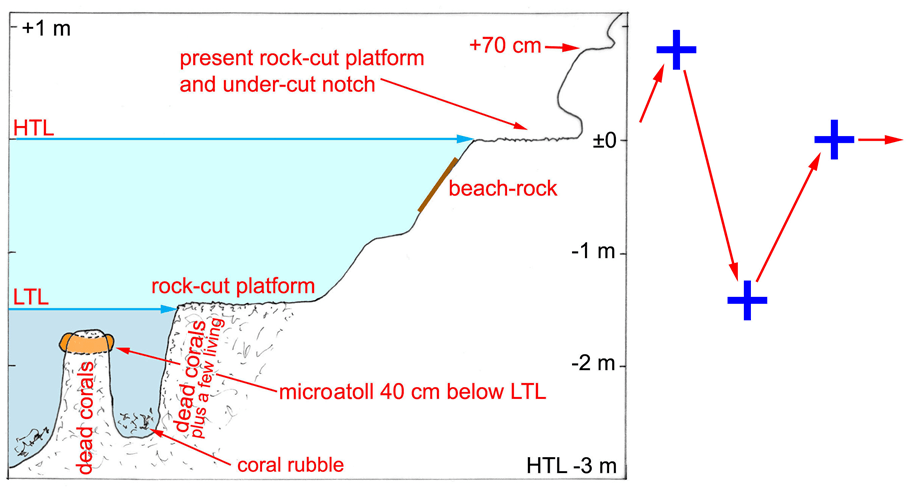
Sea Level Measurement Contortions
What’s involved in estimating sea level by means of satellites? Albert Parker is a seasoned researcher and explains to us laymen in this interview, followed by links to his recent publications. Senior Researcher Questions Satellite Measurements of Global Sea-Level By Ernest Dempsey with my bolds.
With a lot of rhetoric about the claimed sea-level rise and the threat of global warming due to carbon emissions from human activities, the actual science of sea-level measurements and scientific inquiry of the verifiable degree of climate change has been lost in the noise.
The following correspondence with Albert Parker, Ph.D., author of the 2014 paper Problems and reliability of the satellite altimeter based Global Mean Sea Level computation casts light on how reliable the various sea-level measurements are and whether the actual, on-ground science verifies the narrative of carbon-based climate change and alarming sea-level rise.
Ernest: Albert, thanks for taking my call for this Q&A. Would you please tell us about your academic and research background briefly?
Albert Parker: I received my MSc and Ph.D. in Engineering many years ago, before the age of the commercial universities. I have been working after the Ph.D. for 30 years in companies and universities.
I started to work on climate change as an independent scientist, for my personal understanding, after the leaked Climategate emails in 2009, as I was curious to see what was really going on in the raw data.
Ernest: Can you please tell our readers the various methods scientists have used to measure the mean sea level at any point?
Albert Parker: Relative sea levels have been locally measured by tidal gauges for many years. A tidal gauge signal is characterized by oscillations on many different time scales. The tidal gauge signal is monthly averaged. A linear fitting of the monthly average values collected over a sufficiently long time window returns the trend. As the tide gauge instrument can move up and down, these sea levels are relative to the instrument.
The absolute global sea level is a hypothetical measure of the status of the ocean waters. Somebody has produced global mean sea level reconstructions from tide gauges since the 1700s or 1800s. These reconstructions are not reliable. Before the end of the 1800s, there was for example not a single tide gauge covering all the southern hemisphere.
To compute a proper global mean sea level from tide gauges, you should need many gridded tide gauges along the world coastline, and a measure of their absolute vertical motion, both based on a sufficiently long common time window. There is not such a thing yet. As the trends significantly vary from one location to the other, it therefore only makes sense to focus on the average acceleration rather than the global mean sea level trend.
Ernest: In your 2014 paper, you inform that tide gauge measurements of mean sea level show negligibly small annual rise in mean sea level while satellite measurements give us a notably larger rise in sea level globally. Which of these two would you call more reliable and why?
Albert Parker: The only results to consider are local and global average trends and accelerations from tidal gauges of sufficient quality and length. If a global mean sea level from tide gauges can hardly be computed, you may still look at the individual tide gauges of enough length and quality to understand if there is acceleration or not.
And so far, there has been very little acceleration in any tide gauge record over the 20th century and what is passed of the 21st century. Therefore, coastal management can be local, with adaptation measures needed where the sea level rises significantly because of extreme subsidence, and not certain where the sea levels are rising slowly or are falling.
Regarding the satellite global mean sea level, this result is more a computation than a true measurement and it is not reliable. If you try to track by global positioning system (GPS) the position of selected fixed points, such as few GPS domes on land, and you try to compute the GPS time series to derive a GPS velocity, you may then discover that this much simpler computation, also constrained by the geodetic dimensions, still suffers significant uncertainties, because of satellite drift and other technicalities.
It is therefore impossible to measure with nanometric precision the instantaneous height of all the water volume to then derives a time rate of change. The only thing that you can get from the satellite altimeter measurements is an almost detrended, noisy signal, as it was clear in the first results of the project.
If subjective corrections are then applied to this signal, for any reason you get the satellite altimeter results that is not a measure, it is a computation, that lacking validation has very little value.

Ernest: Tell us about calibration and its role in sea level readings.
Albert Parker: It is not just a problem of calibration. You are trying to measure with a satellite altimeter the instantaneous, absolute, height, with accuracy up to the nanometer, of a continuously oscillating mass of water bounded by an irregular, continuously moving surface.
With the much more established and reliable GPS system that serves many more goals than the monitoring of a climate change parameter, it is hard to compute with accuracy larger than a couple of millimeters per year the time rate of change of the position of fixed GPS domes. The global mean sea level results of the satellite altimeter are unfortunately never validated computations, not certainly very accurate measurements.
Ernest: The observable change in sea level can be due to increasing the amount of water in the oceans or upward tectonic movement of the seafloor, right? Is there any way to tell how much rise resulted from either?
Albert Parker: The situation is a little bit more complicated. If you look at the relative sea level trends across the world, they rise and fall because of changing water conditions and land movements. If you are along the Pacific coast of the US for example, in Alaska, the sea levels are generally falling because the land is moving up (uplift). Conversely, if you look at California, the sea levels are rising mostly because the land is moving down (subsidence). Local factors produce significant differences in between the rates of sea level rise (trends).
To get an accurate measure of the sea level rise by thermal expansion and mass addition from tide gauges, this is not easy. What we can see from the individual tide gauges, is that the contribution from mass addition and thermal expansion is about constant since the start of the 20th century.
Since the year 1900, the warming of the oceans and the melting of the ices on land has therefore basically provided an almost constant contribution to the rate of rising of sea levels. Same time, the anthropogenic carbon dioxide emission has increased exponentially. This would be enough to conclude that the anthropogenic carbon dioxide emissions have very little influence to no influence at all on the rate of rising of sea levels.
Ernest: Then there is the question of periodicity. Far as I get it from your paper, it is more scientific or reasonable to look at sea level change over the past least 60 years. Why is that?
Albert Parker: The sea levels are very well known to oscillate with many periodicities up to quasi-60 years that is well shown in almost all the world tide gauges. If you study a tide gauge record and you want to compute a trend by linear fitting, you do need data collected over a time window long enough to understand what is a multidecadal natural oscillation and what is a sea level acceleration produced by intensifying mass addition and thermal expansion. It is unfortunately common to find peoples who cherry pick the short-term positive oscillation in selected locations to sell this result as the proof that global warming is real.
Obviously, the cherry pickers do not pick up the cherries in areas of opposite short-term oscillation where the same approach could prove there is global cooling equally real. Similarly, they do not consider the fact that in the long-term locations, positive and negative phases of the oscillations have regularly followed each other over the time, and “unprecedented” short-term sea level rises have been measured already about 60 years ago.
Ernest: Since you pointed out the shortcomings in sea level measurements by satellite altimetry and GPS, has the environmental science community responded to your work?
Albert Parker: The shortcomings of satellite altimetry to compute sea levels are very well known. The most part of the independent scientists, unfortunately mostly retired, acknowledges that there is something not that straight going on in the satellite altimeter result. Nils-Axel Morner and many others have written wonderful papers questioning the sea level claims.
The problem is the dependent scientists, working in a commercial academy, and more than them, the general press and the politicians that have a clear interest to force the peoples to believe that global warming is real and they need more administration and control and more taxes.
Ernest: Speaking of press, we hear a lot in media about new researches finding links between anthropogenic carbon in atmosphere and sea level rise. And some have claimed disastrous consequences of this supposedly impending sea level threat. What’s your response when you read those stories?
Albert Parker: In the recent scientific paper reference [1], that, of course, will not receive any attention by the alarmists, we discuss how different experimental data sets of tide gauges show relatively small sea level trends, from +0.4 to +2 millimeters per year, and negligibly small sea level accelerations, just a few micrometers per year squared.
These results demonstrate that the sea levels have not been driven by the anthropogenic carbon dioxide emission over the last 120 years, and it is very unlikely they will start to be driven by magic right now. These trends and accelerations translate in forecasts to the year 2100 of 100-200 mm sea level rise, not certainly the 850 mm by the IPCC, nor the 1,670 or the 3,050 mm of works such as reference [2] or [3].
The figures below are a comparison of sea level measurements vs. sea level computations over the time window 1970 to 2017, and evidence-based forecasts to the year 2100 vs. the model predictions. The difference amongst latest models and reality is increasing as opposed to being lessened. It should be the opposite. Many may certainly claim new links between the anthropogenic carbon dioxide in the atmosphere and the sea level rise, with disastrous consequences of this supposedly impending sea level threat. This does not mean they are correct.

From these graphs, we already know that up to 2017 the models have been wrong, and it is increasingly unlikely to expect more rather than less sea level rise by 2100 vs. the already exaggerated IPCC predictions.

[1] Parker, A. & Ollier, C.D., CALIFORNIA SEA LEVEL RISE: EVIDENCE-BASED FORECASTS VS. MODEL PREDICTIONS, Ocean and Coastal Management, Ocean & Coastal Management, Available online 19 July 2017, In Press, Corrected Proof. doi: 10.1016/j.ocecoaman.2017.07.008
Read more at Science Matters


All these liberal journalists are sounding as bad TIME a few years ago with their BE WORRIED BE VERY VERY WORRIED on the font cover of their liberal rag all this false alarms the news reptiles are spreading all these leftists mews reptiles and scandal mongers are just looking to sell their libera rags and we all ready know CNN lies once being owned by Red Ted Turner who brainwashed kids with junk like Captain Planet as well as Network Earth and National Geographic Explorer