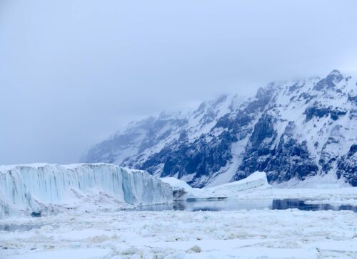
According to a recent statement by NASA, West Antarctic glaciers and sea ice are melting due to atmospheric global warming.
What NASA fails to mention is that geothermal heat from the West Antarctic rift (part of that area’s tectonic plate system) is warming the ocean water, which in turn is causing the ice sheet to gradually melt faster than normal.
This statement, incidentally, coincides with the Climate Conference now gathered in Lima, Peru.
Climate models, however, do not take into account the impacts of plate tectonics on ocean warming, and much current modern weather phenomenon can be directly tied to current geological events: local continental glacial melting, local droughts, local warming ocean, selective polar ice melting, La Nina, and El Nino, etc.
Until recently, vertical segregation of the deep oceans was argued as a reason to not include the deep oceans and deep ocean floor in climate models. This notion has changed in the last few years as observed natural climate variations were difficult to explain based solely on atmospheric models.
All deep ocean phenomena should now be included in climate models because of their powerful effects on ocean temperatures.
It strengthens a long-standing contention that geological influences from deep-ocean floor surfaces such as plate junctures, transverse faults, volcanically active areas, etc., should be considered in climate modeling.
Please read this assessment of global warming and plate tectonics published previously for more background information on this important topic.
NASA’s latest announcement uses Amundsen Sea Embayment as proof that glacial melting and sea ice retreat is proof of atmospheric global warming.
They theorize that slightly warmer seawater is being “channelized” from the ocean laterally underneath the glaciers along a long, topographically low valley that exists beneath the ice.
NASA contends that this large linear rift valley extends onto the continent and is somehow conveying atmospherically warmed seawater great distances onto the continent.
This rift valley, known as the Ferrigno Rift, was discovered under the Ferrigno Ice Stream in “2010 by a team from the British Antarctic Survey and the University of Aberdeen,” led by Robert Bingham.
In geology, a rift is a linear zone where the Earth’s crust and upper-most solid mantle are being pulled apart.
This research is shown in the diagram below:
Robert Bingham’s research states that the Ferrigno Rift valley was formed in response to faulting along a significant geological rift system. This active geological rift is part of the larger and very well known West Antarctic Rift System.
As is shown in his research, the Ferrigno Rift is highly faulted, 1.5 km deep, 10 km wide, extending at least 100 km into the Antarctic Continent.
This is a very important geological discovery because it further documents the regional extent of the greater West Antarctic Rift System.
Like all active rift systems, the Ferrigno Rift System should have significant heat flow, as it is also part of the West Antarctic Rift system.
Recent publications have shown that heat flow from portions of the West Antarctic Rift is, in fact, the cause of bottom side and overall ice melting of the Ross Ice sheet.
Additionally, recent research shows that the vast network of sub-glacial freshwater streams and lakes, most of them concentrated along the West Antarctic Rift, were created from geologically induced geothermal heat and fluid release from the West Antarctic Rift System.
With the West Antarctic Rift being very active and emitting heat, and the Ferrigno Rift is part of this larger Rift System, it seems only logical to deduce that the Ferrigno Rift is also releasing heat and melting glaciers in the Amundsen Embayment Area.
Searching for any information that shows Robert Bingham et al not referring to heat release in his research of the Ferrigno Rift has yielded nothing. Searching again that he or anyone else, drilled into the rift also showed no results. Bingham discovered the rift using ice-penetrating radar, according to Wikipedia.
This is important because geothermal heat released from the main portion of the West Antarctic Rift was not confirmed until researchers actually drilled through the overlying ice sheet and into the bedrock.
These wells found elevated geothermal heat flows, unusual chemical contents associated with a geothermal release, methane, unusual biotic species, and most importantly, large freshwater lakes and streams.
It is understandable to some degree why Robert Bingham et al did not consider geothermal heat as an alternative explanation for the Amundsen Area ice melting. They only did surface work by geophysical methods.
Why is there a very large embayment (a coastal recess forming a bay) in the Amundsen area? The obvious answer is that the rift valley extends out into the ocean and forms this alcove as heated water generated from the rift faults empties into the ocean.
It is important to emphasize that this warmer water would not be due to atmospheric warming, but instead geologically induced warming from rift faults.
See here and here for more information on West Antarctic glacier melting from geothermal heat sources.
A more plausible explanation regarding the West Antarctic ice sheet melting is related to the geology of Antarctica and its associated fault system.
Furthermore, it is likely that this melting has very little, if anything, to do with atmospheric-based global warming.
It is important to note, as is the case with many aspects of climate science, that tectonic plate climatology is still in its infancy.
While climate scientists continue to struggle to explain many recently observed natural climate patterns and climate-related phenomenon, including the global-warming “pause,” the theory of plate climatology and its influence on global phenomena should be given strong consideration.
Download the Full Synopsis and Article here.


