 As delegates from the climate conference in Glasgow streamed home in mid-November, with the official start of the Australian summer just days away, Melburnians were freezing, there were floods in NSW and it was snowing in Tasmania.
This is not the climate hell of searing heat and empty dams scientists and activists have been forecasting for the past 30 years and more – the hell which the annual climate summit held in Glasgow was supposed to help the world avoid.
Instead, the wintery weather underlined a basic point that climate activists, including some scientists, are extremely unwilling to acknowledge.
For as well as being extremely variable, weather is subject to climatic cycles that are simply not covered by the allegedly ‘settled, certain’ global warming theory.
After thirty years of doomsaying about climate, these variations can still turn near-summer into winter within days and dictate seasonal rainfall.
The unseasonable cold in Melbourne and rainstorms in NSW, following more rain in Queensland, were mostly due to weather variations including a cold front moving from west to east.
But it is worth noting that three climatic features known as the El Nino/La Nina (or the El Niño Southern Oscillation) effect, the Southern Annual Mode (SAM), and the Madden-Julian Oscillation (MJO) may all be influencing these events.
Of these, by far the best known is the El Nino/La Nina effect, which is now in its La Niña phase. Broadly, the effect involves changes in sea surface temperatures altering the circulation of wind and rain-bearing clouds in the Pacific. The La Niña phase generally means cooler, wetter conditions for Australia’s eastern seaboard.
Scientists can forecast changes in the cycle several months in advance through monitoring sea surface temperatures, but the effect itself is due to changes in deep ocean currents that are at best only partially understood.
Although most forecasting bodies say a La Niña has developed, the Australian Bureau of Meteorology (BOM) is, as always, more conservative.
In mid-November, the bureau’s website estimated a 70 percent chance of a La Niña forming in the coming months. The bureau’s website also notes that several climate drivers are combining to produce the current wet seasonal outlook for Australia.
Another is the previously mentioned Southern Annular Mode (SAM), which is a belt of strong westerly winds that blow around Antarctica.
This belt of winds can shift south – the SAM index turns positive – and when it does in summer, says the BOM, that usually means wetter weather for eastern Australia, but drier-than-average conditions for western Tasmania (this reverses in winter). As of mid-November, the SAM had been positive for several weeks.
The Madden-Julian Oscillation (MJO) can be characterized as an eastward moving ‘pulse’ of cloud and rainfall near the equator that typically recurs every 30 to 60 days. This can also be complex to track but also, the bureau says, looks set to bring above-average rain to north-eastern Australia.
Western Australia is subject to a different climate cycle, the Indian Ocean Dipole.
How does the increase in global temperatures over the past century or so, whatever the cause of the increase, affect these cycles? The short answer is that no one knows.
As noted, the mechanism behind either an El Niño or a La Niña occurring is little understood. The shifts between the three SAM phases of positive, negative, and neutral can happen at any time with the change lasting for several weeks.
The MJO, which influences much else in the Earth’s climate besides rainfall in northern Australia, has been the subject of considerable research but forecasting it has a long way to go.
The issue has been further confused over the years by enthusiastic climate doomsayers, often with little knowledge of climate, associating higher temperatures with reduced rainfall.
For its part, BOM says on its website that ‘rainfall across northern Australia during its wet season (October–April) has increased since the late 1990s.
In recent decades there has been a trend towards a greater proportion of rainfall from high-intensity, short-duration rainfall events, especially across northern Australia’.
So much for earlier forecasts of other groups that Australia’s droughts would become deeper and longer, but then climate science does not have a good forecasting track record. A case in point is the two polar caps, which are supposed to be melting away.
The extent of sea ice around the Arctic reached a record low in 2014, at least as far as satellite records show, which prompted forecasts that sea ice would have vanished entirely by 2035.
With fourteen years to go, graphs produced by the National Snow & Ice Data Centre show that the extent of sea ice for the 2021 season is well below a thirty-year average but still above the 2014 minimum.
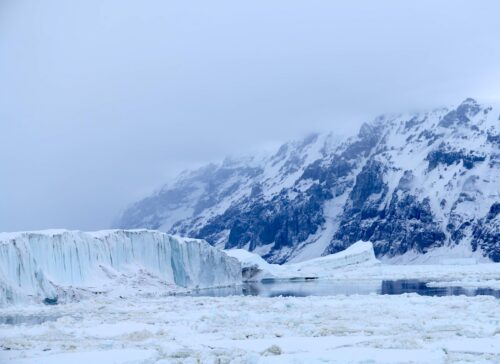
As for the Antarctic, since the 1990s and for many years until well into this century the media would report that the Wilkins Ice shelf, at the base of the Antarctic Peninsula (south of the South American tail), was collapsing ‘for the first time in history,’ often using the same file photograph from the previous year.
Despite this history, in June the European Union’s Earth observation program Copernicus could note only that the sea ice in Antarctica was the ‘eighth lowest in the satellite record’ (which starts in the late 1970s).
None of this indicates that climate is approaching any sort of tipping point.
But instead of asking why, after decades of alarmism, northern Europe and the US can still expect a brisk winter – depending on the forecaster – or why we are getting heavy rain instead of the forecast droughts, delegates to the COP26 conference in Glasgow were still thumping the climate alarm button for all it was worth.
But then, as widely forecast before the event, the climate summit produced an agreement that meant little. The final declaration included vague promises of a ‘phase down’ of the use of coal and for participants to commit to additional cuts in emissions goals for 2030 by next year.
As with the previous 25 meeting statements, all but a handful of developed countries will ignore the agreement or make a token effort to comply.
The US and China announced that the two countries would ‘cooperate on a transition to cleaner energy,’ whatever that might mean, then exchanged barbs over President Xi’s failure to attend the climate summit.
Climate politics has developed into a farce largely unconnected with anything that might actually be happening in climate.
This would be amusing if activists and politicians who should know better did not insist that it has to be taken seriously.
Read more at Spectator AU


Here on Gold Coast it has been cool, really wet , 200mm or 8 inches in a few days, feels more like mid autumn than almost summer. Hey, a question for the weather people, “How come we only find out we are in a La Nina pattern now after heavy rain?” Too busy making up fake news I guess.
I live in Sydney Aus and we have had so much rain and temperatures so cool. Its 1 weeks to Summer and plenty of people here wearing coats. Amazing with our supposed longest Sunlight hours now. Same with other areas in Eastern Australia.
I would like to see it snow on all those Global Warming/Climate Change advocates as well as the Anti-Fossil Fuel idiots as well lets see Gore,DiCaprio and David(Laurie)Stranded in Gores Home with lots of snow
Harrison Ford too, another climate idiot
Good update.